Popular destinations nearby
Eger,
Miskolc,
Aggtelek,
Egerszalók,
Hollókő,
Jósvafő,
Sárospatak,
Tokaj,
Hollóháza,
Mátraszentimre,
Mátraverebély,
Mezőkövesd,
Parád,
Sátoraljaújhely,
Sirok
|
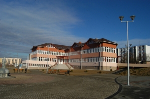
Town with 16,000 inhabitants 8 km south of Salgótarján in the valley of Zagyva between Mátra and Cserhát Mountains. Four formerly independent villages, Nagybátony, Kisterenye, Szupatak and Maconka, with significant traditions of their own had been united to make Bátonyterenye. The original settlements are symbolized by four jets of flame bursting out from a ground black diamond in the coat-of-arms of the town. The imperial domed, which is rather unique in Hungary, late Baroque Gyürky-Solymossy mansion with a well-kept 11 hectare garden is in the Kisterenye part of the town. The church is of late Baroque style, built with bulbiform cupola similar to the mansion. Statue of writer Lajos Abonyi in the garden of the mansion, at the place of the city feasts. Palóts Landhouse can be found in the neighbourhood of the park. The 14th century church of Maconka with its medieval frescoes in the sanctuary is of special interest for tourists. The Roman Catholic church of Nagybátony is a Baroque building erected in the 18th century. A harmonic village scene welcomes the visitor by the Lutheran church and its environment in Szupatak. Among others the Youth Camp of Szorospatak offers excellent venues for a prolonged holiday in tents. The Ady Endre Cultural Centre is one of the most splendid cultural buildings of the county. With its 15,343 inhabitants Nagybátony, part of Bátonyterenye, is 8 km south of Salgótarján. Roman Catholic church at Maconka (built in Romanesque style in the 12th century, later rebuilt in Baroque style), with 16th century frescoes and late baroque sculptures. Gyürky-Solymossy castle with park under protection. Lodgings in Bátonyterenye: Pictures of Bátonyterenye
|
Bátonyterenye map nagyítása >>
|
|
|
Hungary - Bátonyterenye |
|
|
|
||
|
Monday, 29. December 2025. - 13:14:45 |
||
